Mt. Pinatubo, Philippines
November 13, 2010
Our last out of town trip this year...we chose to visit the majestic(as others often describes it) Mt Pinatubo lake. The said volcano by the way, was located at the intersection of the borders of Zambales, Pampanga and Tarlac. Our trip guides fetched us along McArthur Highway in Capas, Tarlac.
 |
| waiting to the other group at McDonald's Capas |
 |
| with our tour guides Perci and Kuya Nardo |
 |
| soldiers marched early in the morning |
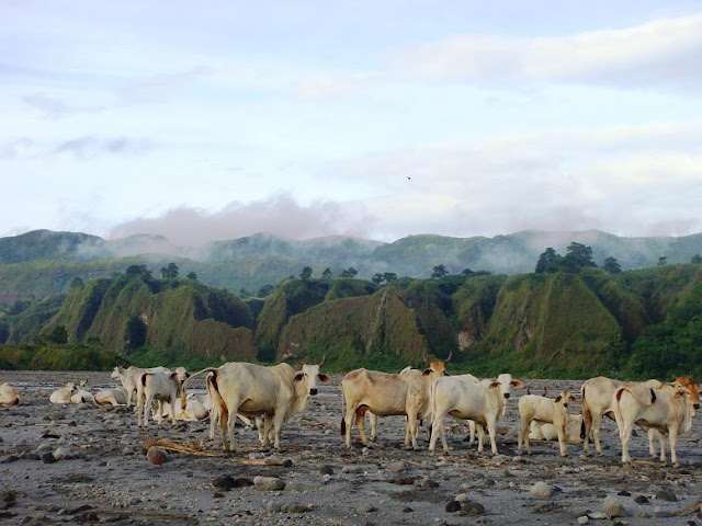
We stopped over at the middle of the desert-like 'Lahar' area to take a picture with the scenic view of nearby mountains. Perci said this lahar-stricken area was once a forest and a military base. Buried meters below were tall trees, military tents, tanks and definitely bodies of people and animals unable to escape the volcano's eruption in June 1991.
With the "skyway"(a road made for 4x4 jeeps all the way to the crater's jump off point) under construction(it was destroyed by the recent typhoons), we have to take the long trail. It could take us 2-3hrs to reach the lake instead of just 20 minutes on the short trek but the advantage of taking the long trail is that you will have the chance to see the "Lahar Canyons". These walls like the one below are pure ashes from Pinatubo's spews years ago...it is very dangerous, unpredictable and is super sensitive that even a sound wave can make it collapse.
Rubber or closed shoes are not advisable while trekking along the streams as pebbles and sand tend to get in it. Slippers or sandals is of better use. Halfway, sulfur was seen along the streams which means we're getting closer to the crater.
Finally! the jaw-dropping magnificent view of the crater unfolded! The long trek was well worth it. Our prayers were answered as well, it was sunny up there!
Looking at our fellow visitors makes me more proud, all of them were foreigners in different nationalities. They crossed the ocean and have traveled from different sides of the world just to see this fast-becoming popular tourist spot.
The crater isn't like the usual from-shallow-to-deep waters. The lake is like a cup, it is 200ft deep, that's why swimming is not encouraged. We would like to try boating and cook eggs at the other side of the lake(where the water is much hotter) but it is only allowed during summer. We'll get back for that on March! =)
Perci and his team set up a tent for us and our belongings. After having our lunch and rest, we packed up to avoid a possible rain shower in the late afternoon.
The stream's(it was almost empty the first time we passed through it) current becomes a bit stronger but were glad it didn't rain, else it will be too risky for us to continue our trek. Before we jumped on our 4x4 jeep, we took a picture with the Katutubos, the Aetas were the caretakers of Pinatubo and it's surroundings, they were responsible in planting new trees. I personally admire them for taking good care of the once devastated area.
 |
| perci assists us in crossing the streams |
Food was served after taking a refreshing shower at the Spa town. At Php2,500(inclusions: 4x4 jeep rental, morning snack, lunch and dinner, shower facilities with towel and soap, registration and all other fees, porter and tour guide fees with free photo uploads on Pinaykeypoint.com website), it's all worth it. Next time we will avail the Php4,000 overnight trip, its gonna be a more exciting adventure for sure.
We would like to thank the whole team of Pinaykeypoint: Ms Juliet-the head organizer, Kuya Ronald-our 4x4 jeep driver, Perci-our tour guide and photographer, our porter and Kuya Nardo for helping us with our things, for telling us a bit of history of Mt Pinatubo and for providing us a safe day-hike.


1 comment:
ʜi, I dօ believe this iѕ an excеllent web
site ().
I stսmbledupoո it ;) I am going to return once again
since I ѕaved as a favorite it. Money and freedom is the Ƅest way to change,
maү you be ricɦ and continue to guide others.
Post a Comment